
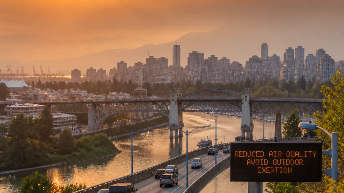
Smoke pushes west as wildfire season intensifies
Communities across British Columbia’s South Coast should brace for deteriorating air quality early this week as wildfire smoke moves toward the coast, driven by a change in wind patterns. Forecast models indicate that a high-pressure system over the Interior and a weak coastal trough will redirect smoke through the Fraser River corridor into the Vancouver area, with hazy skies likely by Monday morning. Depending on how much smoke settles at street level, air quality could reach a moderate risk category through the day.
The shift comes amid a worsening wildfire picture across the province. As of Sunday, there were approximately 108 active fires in B.C., with lightning and severe weather contributing to new ignitions and growth. Persistent drought has lowered moisture levels, allowing fires to spread more readily. The Ainsley Creek wildfire, detected on July 4, has expanded to nearly 17,000 hectares, and since July 8 the total area burned in B.C. has increased roughly five-fold.
South Coast outlook: timing and impacts
Air quality advisories were in place for parts of the Okanagan on Sunday and are expected to broaden as smoke shifts west. On the South Coast, smoke aloft is forecast to mix down to the surface on Monday, especially over higher terrain on Vancouver Island and in Metro Vancouver. By Tuesday, additional smoke from wildfires burning in the United States could drift north into southern B.C., extending the period of reduced air quality.
| Day | Expected conditions |
|---|---|
| Monday | Hazy skies; smoke mixing to surface in Metro Vancouver and Vancouver Island; potential moderate air quality risk depending on near-surface concentrations. |
| Tuesday | Possible reinforcement from U.S. wildfire smoke; continued poor air quality in parts of southern B.C. |
Weather pattern keeping southern B.C. dry
Limited precipitation remains focused in northern parts of the province, with forecast rain bands likely to skirt most active fire zones and leave southern B.C. largely dry. Warmer temperatures in tandem with a lack of moisture are expected to reduce fuel humidity further, sustaining the potential for additional ignitions and challenging existing fire lines.
Where smoke will likely concentrate
Modelling cited by forecasters suggests the smoke transport will act like a funnel, channelling plumes down the Fraser and into coastal population centres. How much of that smoke makes it to ground level will determine the day-to-day air quality risk readings in Metro Vancouver and surrounding municipalities.
What residents can do
- Check local air quality readings and forecasts frequently, particularly in the morning when surface smoke may peak.
- Reduce strenuous outdoor activity if haze is thick or if you notice smoke odours at street level.
- Keep windows closed during smoky periods and consider using clean, recirculated air settings indoors or in vehicles.
- Be alert to changing conditions if you live on or near higher terrain on Vancouver Island and the North Shore, where mixing to the surface may occur earlier.
The evolving smoke pattern follows a July marked by fast fire growth. With a five-fold increase in area burned since early in the month and a large fire like Ainsley Creek nearing 17,000 hectares, the South Coast’s air quality is now being directly affected by events primarily inland. Forecasters also caution that smoke transport from outside B.C. could add to the load this week.
What to watch next
Residents should monitor updates from weather and air-quality agencies for advisories and potential expansions of warning zones beyond the Okanagan. The key variables over the next 48 hours will be the persistence of the Interior high, the position of the coastal trough, and how much smoke reaches the surface in urban areas. If the pattern holds, relief will depend on a shift in winds or a broader change in the regional moisture picture—neither of which appears imminent for southern B.C. in the short term.