Northwest sees seven new starts as province-wide tally reaches 191
Ontario’s wildfire situation intensified heading into the weekend, with provincial authorities reporting 191 active fires across the North as of Saturday morning. The Aviation, Forest Fire and Emergency Services (AFFES) agency confirmed seven new fires in the northwest Saturday afternoon, bringing that region’s count to 132.
Officials said overcast conditions and overnight rain have tempered fire growth and behaviour across active incidents. Despite the brief reprieve, the wildfire environment in northwestern Ontario remains volatile, and fire crews continue to prioritize threats to life, critical infrastructure and communities.
Thunder Bay ramps up supports amid escalating fire activity
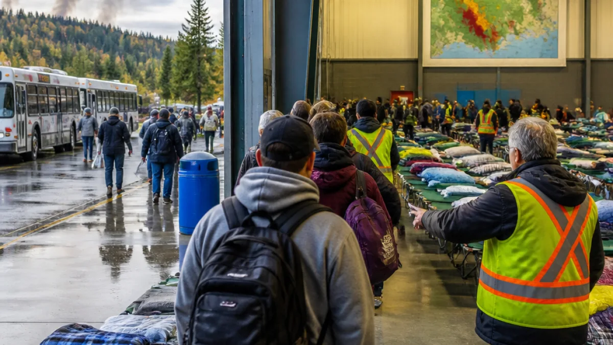
An evacuation centre has been opened in Thunder Bay to accommodate people displaced by northern wildfires. During a visit to the city, Premier Doug Ford underscored the need for residents under evacuation advisories and orders to comply so crews can operate safely and efficiently around threatened areas.
Local and provincial partners are coordinating lodging and essential services for evacuees arriving from affected communities. Authorities say capacity will be adjusted as conditions evolve and as more people are moved from areas where smoke and fire behaviour pose health and safety risks.
Where new fires were confirmed
AFFES detailed the seven most recent fires in the northwest, spanning Nipigon, Kenora, Fort Frances and Sioux Lookout districts. Sizes and status vary widely, from small, called-out fires to larger incidents being monitored due to conditions and access.
| Fire ID | Nearest area | Approx. size | Status |
|---|---|---|---|
| Nipigon 67 (NIP067) | W of Crib Extension Rd., SE of Cavell Lake | 5 ha | Not under control |
| Nipigon 68 (NIP068) | N of Percy Lake | 0.7 ha | Not under control |
| Kenora 19 (KEN019) | Island in Black Sturgeon Lakes, E of Peterson Rd. | 0.1 ha | Called out |
| Fort Frances 40 (FOR040) | Near Rocky Island Rd. & Hopkins Bay Islet Rd. | 0.1 ha | Called out |
| Fort Frances 41 (FOR041) | N of Secret Lake, near Sedgwick Lake Rd. | 0.1 ha | Under control |
| Sioux Lookout 98 (SLK098) | North end of Michikenis Lake | 110 ha | Being observed |
| Sioux Lookout 99 (SLK099) | About 4.5 km N of Wharram Lake | 136.6 ha | Being observed |
Fire behaviour moderated by weather, but risks remain
Cloud cover on Friday and rainfall overnight helped limit spread and intensity across multiple incidents, according to AFFES. That has given ground crews and aerial resources an opportunity to consolidate containment lines where access allows. The province continues to caution that conditions can shift quickly with wind and drying, particularly in the northwest where fuels remain susceptible.
Authorities have reiterated that staying in areas under evacuation orders or resisting to leave can delay operations, divert resources and put both residents and responders at risk. Compliance allows teams to focus on suppression around communities and critical corridors, including areas where smoke may reduce visibility for aircraft and ground traffic.
What residents need to know now
- Follow local advisories and any evacuation orders from municipal officials and emergency managers.
- Check provincial wildfire updates from AFFES for current fire locations, sizes and status.
- Expect changing conditions; smoke and shifting winds can alter risks rapidly even where growth has slowed.
With more than one hundred ninety active fires on the landscape and new starts being detected, officials say the coming days will be critical for stabilizing larger incidents and moving affected residents to safety. Thunder Bay’s expanded supports are intended to keep pace with displacement needs as the wildfire response continues.