
Updated mapping reduces estimated size; evacuation order remains in place
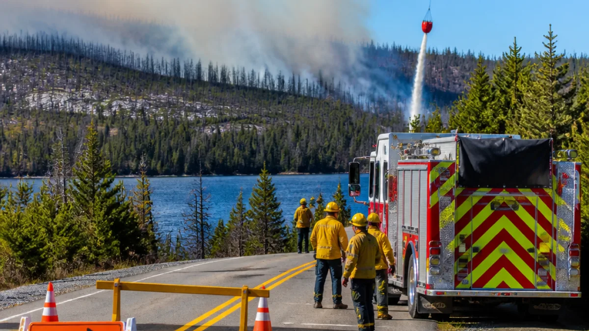
Provincial and municipal fire crews continued a sustained attack Saturday on an out-of-control wildfire northeast of Halifax that has forced residents from their homes along Mooseland Road. The Nova Scotia Natural Resources Department said the blaze, which ignited earlier this week, was mapped at nearly 14 square kilometres following a review that subtracted non-burnable features such as lakes and ponds.
Officials noted the refined estimate is about three square kilometres smaller than what was reported Friday. The change reflects more precise perimeter work rather than a significant shift in fire behaviour. Halifax Regional Fire and Emergency’s evacuation order, issued Thursday night, applies to approximately 100 cottages, cabins and homes along the road corridor and remains in effect as crews work to contain the flames.
Air and ground response ongoing
Aircraft supported firefighters on the ground through the day as teams focused on access points and priority edges of the fire. While officials described the blaze as out of control, meaning it is not yet contained, they emphasized that better mapping offers a clearer picture of where suppression efforts can be most effective.
Authorities have not reported injuries. Residents were urged to avoid the fire zone to keep roads clear for emergency vehicles and to monitor official provincial and municipal channels for the latest on evacuation boundaries and road access. The province typically updates wildfire status reports and public safety notices on its official platforms throughout the day when conditions shift.
Why the fire size changed on paper
Wildfire size estimates can change as teams replace rapid initial assessments with thorough perimeter mapping. In this case, officials said the updated figure reflects the removal of bodies of water and other areas that did not burn, resulting in a smaller but still substantial footprint. Accurate mapping helps direct resources to the most active edges, locate safe zones, and plan for potential wind changes.
| Key detail | Latest information |
|---|---|
| Estimated size | Nearly 14 sq. km (revised) |
| Change from Friday | -3 sq. km due to refined mapping |
| Evacuations | About 100 properties along Mooseland Road |
| Status | Out of control |
Local impact and what to watch
The evacuation order disrupts daily life for households and seasonal properties in a rural stretch northeast of Halifax. Access restrictions may also affect forestry and recreation near the fire line. With ground conditions typically dry in mid-summer, even a modest wind shift can change priorities for crews quickly. Residents in nearby communities should remain alert to smoke conditions and follow health guidance if air quality worsens.
Officials said the province is maintaining a two-pronged approach: keeping people out of harm’s way while targeting the most active sectors of the fire. As suppression lines improve, authorities will assess when it is safe to begin allowing residents back to properties. That timeline depends on weather, terrain, and the fire’s behaviour in the coming days.
Practical information for residents
- Follow evacuation instructions from Halifax Regional Fire and Emergency and check provincial wildfire updates for boundary changes.
- Prepare identification, medications, important documents, pet supplies and essentials in case of extended displacement.
- Stay off forest access roads near Mooseland Road to avoid blocking firefighting equipment.
- Monitor official channels for advisories on road closures and air quality notices.
Authorities underscored that public compliance with evacuation and traffic control is critical to firefighting operations. While more accurate mapping has reduced the reported size of the burn, the fire remains active and dangerous, and conditions can change with little notice.