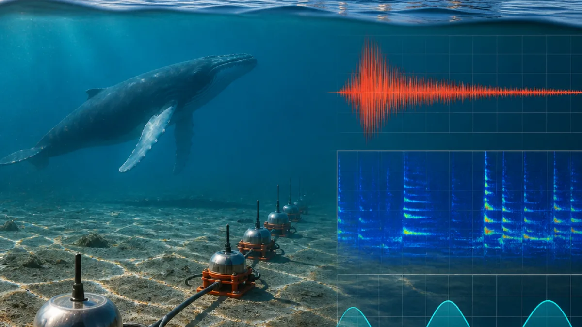
A newly deployed seabed monitoring network in Quebec’s lower St. Lawrence has delivered a step-change in what scientists can track beneath and across the water — and could reshape how authorities design environmental protections. A recently published study describes how the experimental system, built by researchers from McGill University, Natural Resources Canada, the Université du Québec à Montréal and Dalhousie University, recorded undersea earthquakes alongside whale vocalizations, ship noise and tidal activity using a single, integrated network.
Bas-Saint-Laurent testbed captures a fuller picture
The team installed the network along the south shore of the lower St. Lawrence, in Quebec’s Bas-Saint-Laurent region, extending across the estuary between Rimouski and Sept-Îles. According to the study, the instruments remained in place for extended deployments from September through May, between 2023 and 2025. By pairing seafloor sensors with coastal and on-land stations, the system tracked natural signals and human activity at the same time — offering what the researchers call a more comprehensive view of a complex marine corridor.
The authors report a striking performance result: the experimental network detected roughly twice as many earthquakes as the National Earthquake Monitoring System during the test period, while also registering whale calls, vessel traffic noise, tides and even mining blasts. The approach hinges on listening for subtle vibrations where the ocean meets the bedrock.
“I think this is a truly interesting, innovative, and original aspect of this project: for the first time, we were able to install this equipment on the riverbed and leave it in place for an extended period to record all these signals,” said study lead author Yajing Liu of McGill’s Department of Earth and Planetary Sciences.
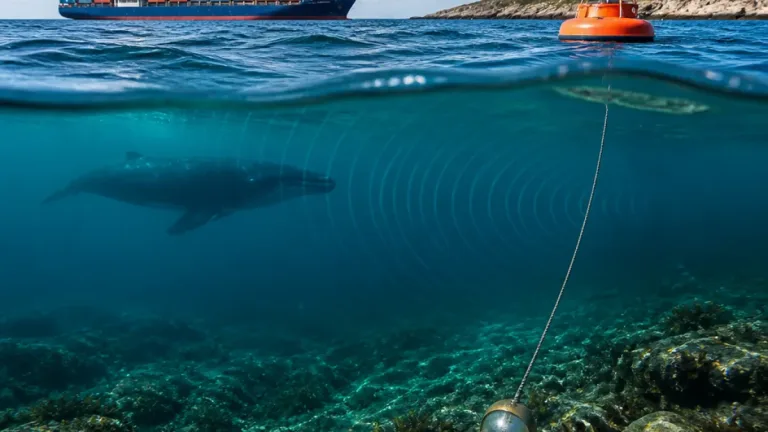
Liu explained the principle simply: seismometers are tuned to any disturbance that shakes or gently quivers the seabed — whether a tectonic shift, the pulse of tides, or acoustic energy from whales moving through the water column and transferring motion to the bottom.
Why this matters for Quebec’s rules and risk planning
The study suggests the network’s unified data stream could help improve environmental regulations. While policy work remains the remit of governments and regulators, this type of continuous, location-specific evidence can give decision-makers a finer view of:
- Where and when whales are present, informing mitigation tools for noise and traffic in sensitive areas.
- Intensity and patterns of ship noise along the corridor, relevant for managing cumulative impacts.
- Local seismic behaviour, a concern in one of Canada’s more active regions for earthquakes, with implications for public safety and infrastructure standards.
- Tidal dynamics and other natural signals that shape habitat and navigation conditions.
Because the technology blends marine and shore-based stations, it can capture what’s happening in, under and far from the water at once. That is a practical advantage for public agencies in Quebec that often must reconcile competing signals — a passing freighter, a migrating whale, or a small quake — when assessing risk or calibrating protections.
How the network is built to listen
The researchers credit sea floor seismometers provided by the National Seismological Research Center and coordinated shore stations for enabling coverage across the St. Lawrence estuary. The configuration, the study says, produced a multi-signal record without having to swap devices for different phenomena. In other words, the same sensor array that hears a tremor can also register a fin whale’s call if the acoustic energy couples into the seabed.
| Component | Role |
|---|---|
| Seafloor seismometers | Detect vibrations from quakes, whale calls, ship noise, tides and blasts at the seabed |
| Coastal stations | Extend coverage along the shoreline, synchronizing signals with marine sensors |
| Inland stations | Provide reference and broaden the array for locating and characterizing events |
The authors describe the output as a composite record of natural and human-made disturbances that can be parsed by type. That means the same dataset can support marine ecology questions and seismic hazard mapping, while flagging the timing and scale of anthropogenic noise.
Study area and timeline
Spanning a busy section of the St. Lawrence — and a habitat used by whales — the project centred on a stretch of the estuary running from Rimouski to Sept-Îles. The team maintained the instruments on the riverbed for prolonged windows across the fall-to-spring months, from September through May, over 2023 to 2025. That seasonal spread is relevant for both marine life presence and winter operating realities on the St. Lawrence.
| Period | Status |
|---|---|
| Sept–May (2023–2024) | Network deployed in estuary |
| Sept–May (2024–2025) | Extended deployment and data collection |
What comes next
The study frames this as a proof of concept for a monitoring approach that could be scaled or repeated. The early finding — twice as many earthquake detections compared to the national system in the test area — indicates value for hazard surveillance. At the same time, persistent logs of whale calls and shipping noise set a foundation for evidence-based conservation and noise-management measures, should policymakers decide to act on the data.
As with any experimental network, the path from peer-reviewed results to day-to-day regulatory use will run through further validation, sustained funding and integration with existing monitoring programs. But by demonstrating that a single seabed array can serve multiple public-interest needs at once, the project offers a practical template for Quebec authorities tasked with balancing marine transport, environmental stewardship and community safety on the St. Lawrence.
Or, as Liu put it, the technical breakthrough here is less about chasing one signal than it is about listening to them together — and keeping the instruments in place long enough to learn from what the river is already telling us.