New underwater network maps a busier, noisier St. Lawrence
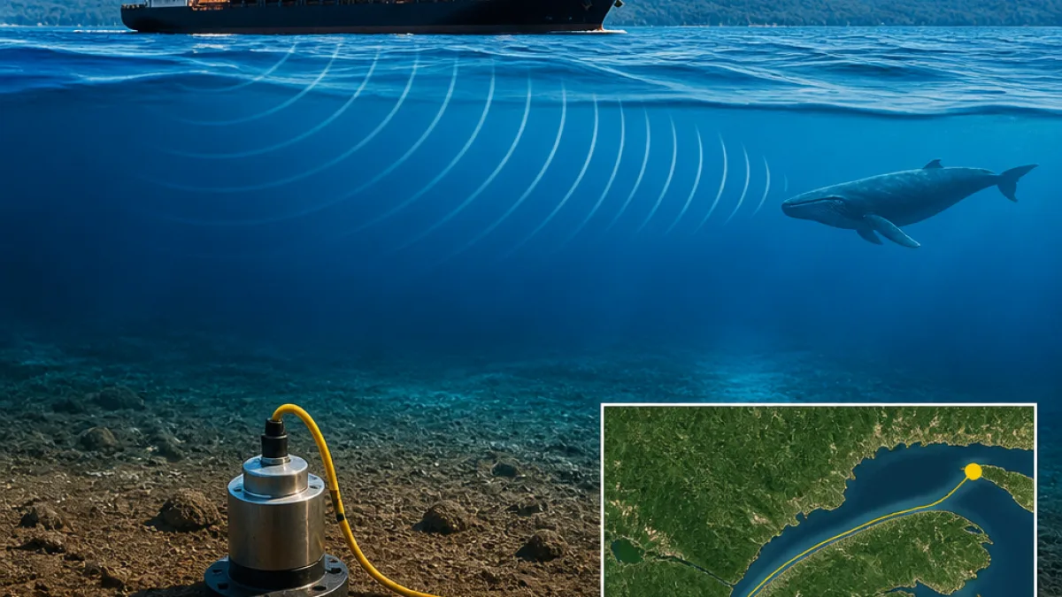
A newly reported marine monitoring network anchored to the seabed of the St. Lawrence River estuary has captured a far more detailed acoustic and seismic portrait of the waterway than existing systems, according to researchers behind the project. Deployed between Rimouski and Sept-Îles from September through May during the 2023–2025 period, the experimental array logged minute vibrations and low-frequency sounds tied to earthquakes, whales, shipping and tides—data the team says could inform stronger environmental rules in a corridor vital to Quebec’s economy and marine life.
Relying on sea floor seismometers provided by the National Seismological Research Center and a series of observation stations, the setup allowed continuous monitoring across the estuary. The group reports the network detected twice as many earthquakes as the National Earthquake Monitoring System over comparable spans, while also preserving an unusually rich record of whale calls, ship-generated noise, tidal signatures and mining blasts that propagate through the seabed.
“We use seismometers to record any source that might disturb or disrupt the sea floor and cause very slight vibrations at the sea floor,” said Liu. “These vibrations can therefore come from an earthquake, but they can also come from the calls of whales, since these emit acoustic waves through the water column and thus disturb the sea floor.”
Whale communication and busy shipping lanes
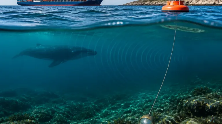
The Lower St. Lawrence is flagged by the team as among Canada’s most seismically active regions and simultaneously one of its busiest shipping routes. That mix, the study notes, places added weight on understanding how human activity overlaps with marine mammal behaviour, particularly when vessel noise masks the frequencies whales use to communicate. The researchers describe a significant concern: when the acoustic bands of traffic and whale vocalizations intersect, communication can be impaired.
To quantify this, the team is building two catalogues—one of whale songs, another of river transport noise—to determine how often, where and when the signals coincide. In one daily slice of records, the instruments picked up whale vocalizations and maritime traffic occurring at the same time and in the same location, underscoring the need to assess potential interference. As Liu put it,
“This is one of the main concerns regarding the estuary and the Gulf of St. Lawrence: the disruption of communication among whales caused by ship noise.”
High-resolution data, heavy processing
Each sensor continuously captured roughly 250 data points per second, generating a torrent of information that the scientists parsed using spectral analysis to separate signatures by frequency. That approach allowed them to segment the record into distinct phenomena—tectonic tremors, passages of commercial vessels, tidal oscillations and industrial blasts—without relying solely on surface observations.
While the project generated a data deluge, the payoff is a coherent, time-stamped record of co-occurrence between biological and anthropogenic signals. For policymakers, the study suggests that such fine-grained monitoring could underpin more targeted mitigation—for example, validating the timing and location of high-noise periods, and strengthening risk assessments in a corridor where seismicity and commerce intersect.
Potential implications for regulation and operations
Though the researchers stop short of recommending specific measures, the findings present a roadmap for regulators and operators. Real-world evidence of overlapping frequencies and temporal patterns can help test the effectiveness of any future interventions intended to reduce acoustic disturbance. For emergency management, the higher rate of quake detection could refine hazard mapping in the estuary and support planning for critical infrastructure along the shoreline.
For shipping firms and port authorities, the work highlights opportunities to align routing, scheduling or operational practices with periods and areas identified as acoustically sensitive. For conservation planners, the catalogue approach offers a basis to evaluate whether noise thresholds are being exceeded where whales are present.
What the network captured
- Detected twice as many earthquakes as the national system over comparable periods.
- Recorded whale vocalizations alongside ship noise in the same places and times on at least one observed day.
- Logged additional signals: tidal activity and mining blasts.
- Sampled continuously at roughly 250 samples/second per instrument.
Deployment snapshot
| Parameter | Details |
|---|---|
| Location | St. Lawrence Estuary (between Rimouski and Sept-Îles) |
| Period | September through May, 2023–2025 deployments |
| Instrumentation | Sea floor seismometers and observation stations |
| Key Outputs | Seismic events, whale calls, ship noise, tides, mining blasts |
As analysis continues, the team is sorting the data into the paired catalogues to map spatial and temporal overlap. That work is expected to guide further inquiry into how often vessel noise obscures whale communication in the estuary and to calibrate the monitoring approach for longer-term use.
The study underscores a central takeaway: seafloor-based listening can convert ambient vibrations into a shared evidence base for government, industry and conservation groups. In a waterway that is both an economic artery and a biologically important habitat, that level of detail could be the difference between broad rules and precision policy grounded in what the seabed is already telling us.